There is no doubt that pictures sell your listing. Many use professional photography to better showcase the homes of our sellers. In a resort area like ours, it is equally important to sell our area. In our last weekly meeting at Tomlinson Sandpoint Sotheby's International Realty, we discussed this issue. Posed was what percentage of our buyers were local? While factual numbers are not given here, it can be said that most who buy in Sandpoint, Schweitzer Mountain Ski Resort, and along Lake Pend Oreille, the vast majority of buyers are coming from out of the area. I would go one step further and suggest that even in areas that don't attract from other places, selling with photos of the neighborhood can be equally important. You are selling local attractions, nature, shopping, and anything else that can better serve your client(s).
While I love photography, I didn't get started until I realized that selling Sandpoint was as important as selling the house. When people are looking to relocate, they first must 'discover' why Sandpoint and North Idaho are special. When possible, I place feel good pics of our area in my listing photos. I also have dozens of websites that promote our region.
In constantly surfing for better pics, I discovered the need for maps, aerial, and satellite photos to help.
Google Earth is one of the best. There are others like TerraExplorer/Skyline Globe, but for ease of use and the ability to print and save images that are customizeable, as well as simple tools for tilting, etc.
Here are some other resources for finding images and maps:
Fish & Game has fantastic cutomizeable maps. Here is the site for Idaho.
I have used Bing Maps, Google Maps, and many others for images. Here are some from those resources:

Google Earth of Lake Pend Oreille

Bing Image of Lake Pend Oreille

Google Maps image of Lake Pend Oreille

Fish & Game map of Lake Pend Oreille Here is the site to make maps for Idaho
There are some fantastic images from space provided by NASA. Here is their searchable database: http://eol.jsc.nasa.gov/
Here are some of their images of Lake Pend Oreille, Sandpoint, Idaho, Schweitzer Mountain and surrounds:


There are other resources that are pay services. For instance, 3DNWorld. Here is an image of Lake Pend Oreille from this source:

There are so many others, like this one:

It is our job to find these resources, sell homes, and promote our communities. Hope this info was helpful.
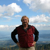
Gary Lirette, featured in Where To Retire magazine and host of the Tuesday noon local radio shows: North Idaho Business as well as North Idaho Arts.

E-mail Gary or call 208-610-1384
Read Gary's Blogs

Tomlinson Sandpoint Sotheby's International Realty
200 Main Street
Sandpoint, Idaho
208-255-3474
www.SandpointID.net - To learn all about Sandpoint and North Idaho
www.RealtySandpoint.com - For Sandpoint Realty
www.SkiSchweitzer.net - To visit Schweitzer Mountain's Community Web

Comments(3)